



The General Structural Plan that the Alicante City Council is working on continues to reveal the future of the city, the portrait it wants to resemble in ten or twenty years, adapted to the foreseeable demographic changes and the projects that are already underway.
Read more One seriously injured after falling from a boat on the coast of Barcelona
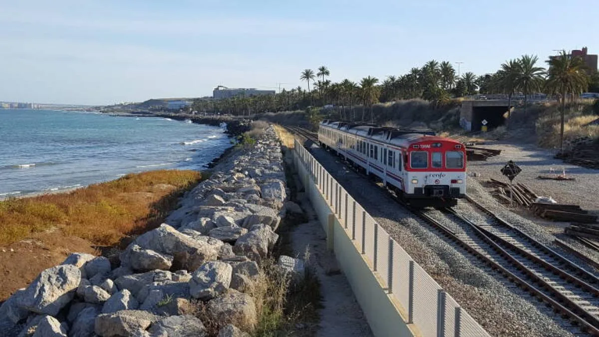
One of the transformations that has been most insistently demanded, the disappearance of the railway line that runs along the southern coast to the San Gabriel stop, is already included in the immediate plans of the Ministry of Transport, so it is necessary to plan what to do with that freed space.
The technicians designing the urban planning document that must replace the outdated current plan consider the conversion of the railway route running along the coastal front into a green, pedestrian, and cycling corridor, which is not limited to running along the coast but also connects with the future Central Park resulting from the release of land next to the central station.
For this to be possible, the space must be freed thanks to the Torrellano Variant and the proposal for a new underground railway access to the Port
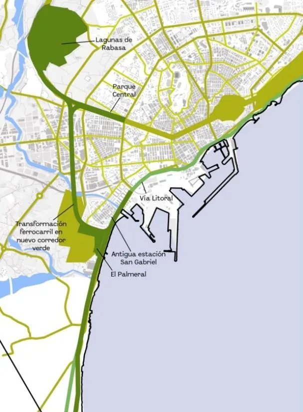
For this to be possible, the space must be freed thanks to the Torrellano Variant and the proposal for a new underground railway access to the Port. This new corridor will connect the coastal axis with the city center and the airport. Urban Planning states that “it represents a key opportunity to strengthen the metropolitan green infrastructure network.”
It is undoubtedly an ambitious project, which will have its urban planning seed in the development of OI/8, which covers the Parque del Mar sector, for which a draft agreement has already been sent to Adif and is expected to be advanced through a specific modification of the current PGOU.
“The transformation of the railway route into a green corridor constitutes a strategic opportunity to advance towards our model of a more sustainable and connected city,” says the Urban Planning councilor, Antonio Peral. “The elimination of urban scars generated by the train tracks is used for environmental and mobility purposes, land use is optimized, and it contributes to improving the urban quality of existing and planned neighborhoods in the area.”
One of the branches of the route will cross two industrial estates, Florida Babel and the Rabasa Industrial Estate, which is planned to be converted into new residential areas to the west of the city, through structural transformation operations that include 12,300 new homes.
Read more A team of surveyors certifies a new 3,000-meter peak in the Catalan Pyrenees
One of the branches of the route will cross two industrial estates, Florida Babel and the Rabasa Industrial Estate, which is planned to be converted into new residential areas
This green corridor is proposed as a strategic element to contribute to the urban regeneration of these areas and the revitalization of neighborhoods such as San Gabriel, which would be articulated and directly connected with the coastal front.
Additionally, it will enable the creation of a green route that directly links the city with the airport, promoting sustainable mobility and accessibility through non-motorized modes of transport. The corridor is conceived as a structural element of the metropolitan green infrastructure with the aim of integrating this action with other green infrastructure initiatives, such as the 19-kilometer Green Belt and the Central Park, reinforcing the coherence of the territorial system and ecological continuity.
On the other hand, it would generate a pedestrian and cycling mobility route connecting the airport and the port, promoting sustainable travel alternatives.
All this while recovering the landscape and environmental quality of the area through renaturalization processes and the application of nature-based solutions, improving the quality of the surrounding areas.
On the other hand, it would generate a pedestrian and cycling mobility route connecting the airport and the port
Equally important will be to promote the connection between new and existing neighborhoods, “boosting social cohesion and strengthening the link with the coast as an identifying element of the territory,” according to the same sources. On paper, it looks great. Whether it will become reality and when, remains to be seen.
Read more Torroella bursts into the summer festival season with the intimate beauty of Beethoven